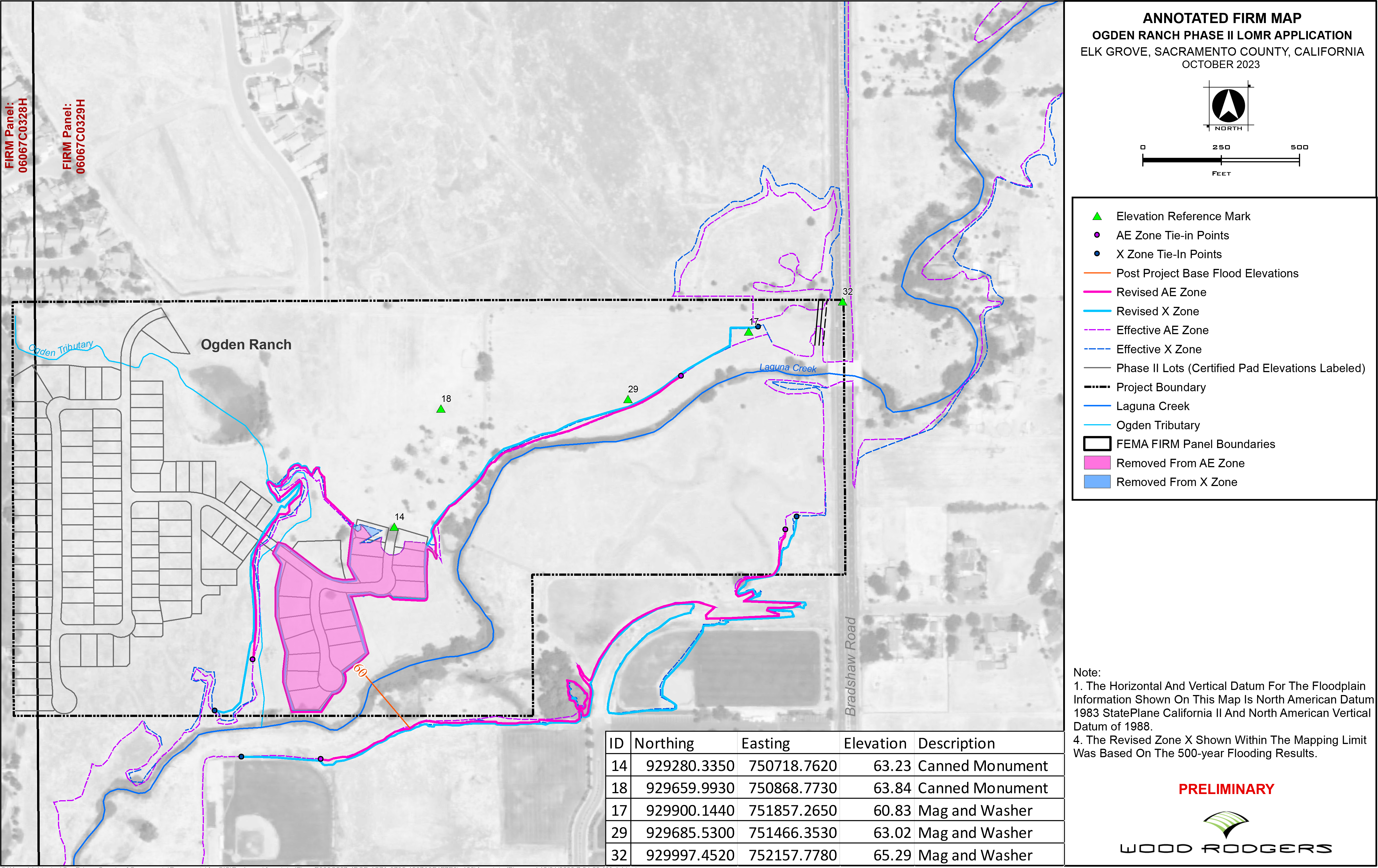
In accordance with the National Flood Insurance Program regulation 65.7(b)(1), Sacramento County hereby gives notice to affected property owners of the intent to revise the flood hazard information along Laguna Creek from upstream of Calvine Road to Bradshaw Road. The LOMR will establish new Base Flood (100-year) Elevations (BFEs). The revision is due to the grading and filling within the floodplain related to a residential subdivision project. The Flood Insurance Rate Map (FIRM) will be revised to show the changes to the floodplain boundary and base flood (100-year) elevations. The FIRM is used to determine flood insurance rates and help the community with floodplain management.
Richmond Homes, with the assistance from Wood Rodgers Engineering, has applied for a Letter of Map Revision (LOMR) from the Federal Emergency Management Agency (FEMA) to revise the FIRM Map for the County of Sacramento, California. The LOMR will increase BFEs along Laguna Creek from between 0.1 feet to 0.3 feet.
A work map of the proposed revision to the flood hazard information can be reviewed at the Sacramento County Department of Water Resources Office, Room 430, 827 7th Street, Sacramento, CA 95814, or by clicking the link below. You may also call Dimitry Mezentsev at (916) 874-5275 or Michael Durkee at (916) 874-8812 for additional information or to ask questions about the project or changes to the floodplain.