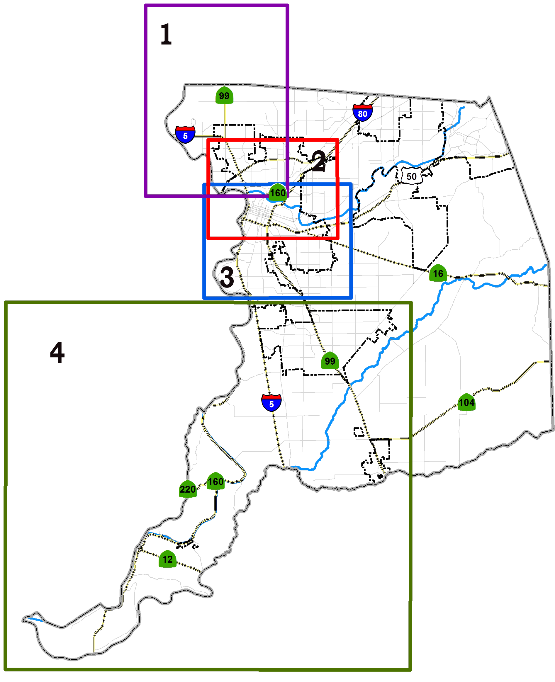
The County of Sacramento and the City of Sacramento have prepared various detailed maps showing hypothetical levee breaks, inundation levels and the time it would take for waters to rise in affected neighborhoods, and rescue and evacuation zones. The County is broken down into four (4) zones: Natomas, north of the American River, south of the American River and the Delta area. You will be able to view maps showing the flood depth for each area and recommended evacuation routes.
**Please Note**
These maps deal with potential scenarios. These are to help you think of how to escape before an emergency occurs. Do not assume that the evacuation routes shown on the maps will necessarily be your way out in a flood. Escape routes could be affected by localized flooding, traffic accidents, and different flooding situations occurring at the time. Emergency officials will monitor roads and let the public know through radio stations and other media if alternate routes should be taken.
Flood Maps
 |
Gardenland North Natomas South Natomas North Sacramento |
 |
Arden-Arcade Rio Linda McClellan Park North Highlands |
 | |
| Curtis Park East Sacramento Florin La Riviera Land Park Meadow View | Midtown North Oak Park Parkway Pocket Rosemont Tahoe Park |
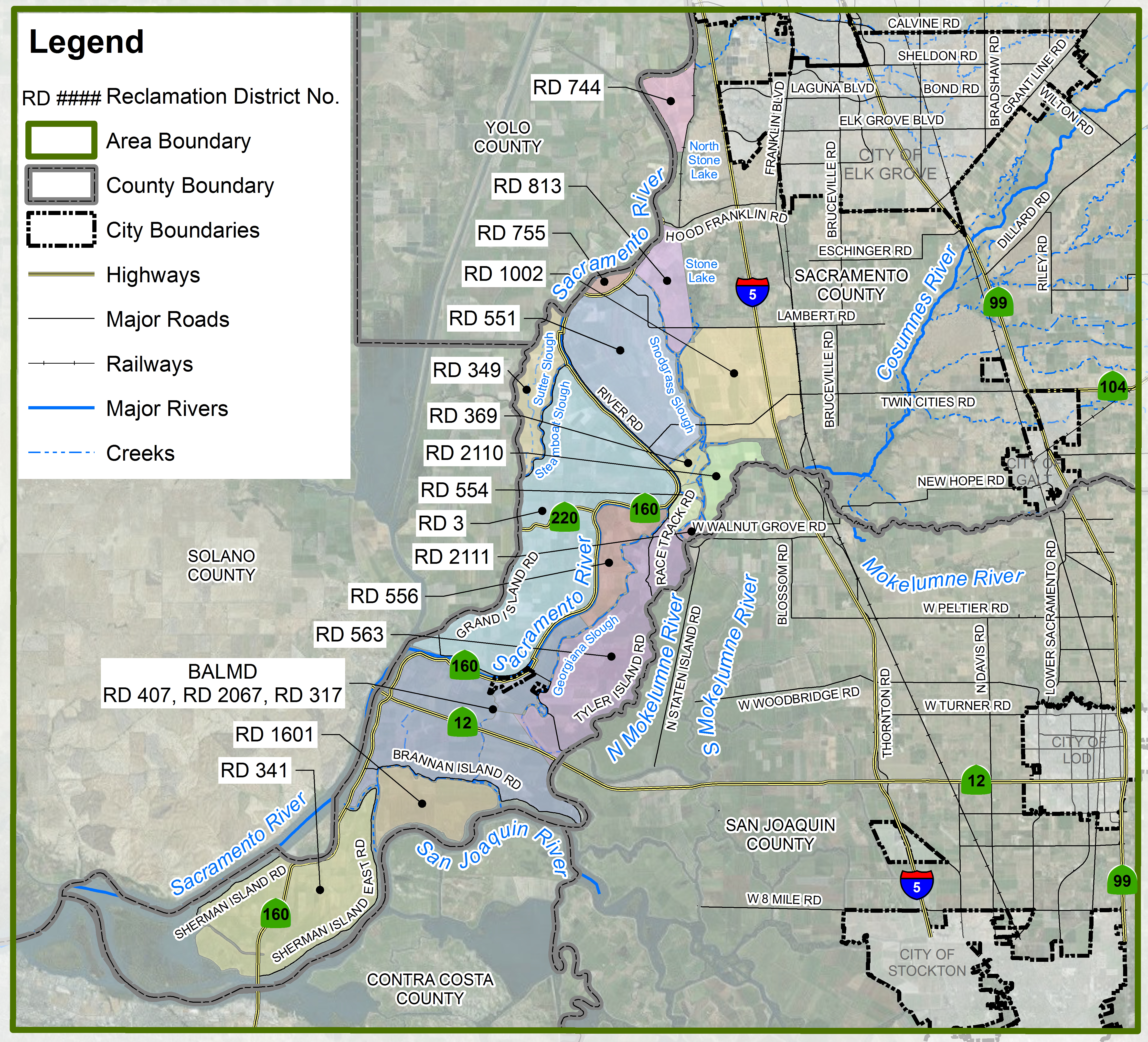 | Courtland Eagle Tree Elk Grove Emmanton Franklin Hood Howard Landing Isleton Laguna Laguna West-Lakeside | Mackenson Mokelumne City Paintersville Ryde Terminous Thorton Vorden Walker Landing Walnut Grove |
Reclamation Districts | 3 | 317 | 341 | 349 | 369 | 407 | | 551 | 554 | 556 | 563 | 744 | 755 | | 813 | 1002 | 1601 | 2067 | 2110 | 2111 |
|
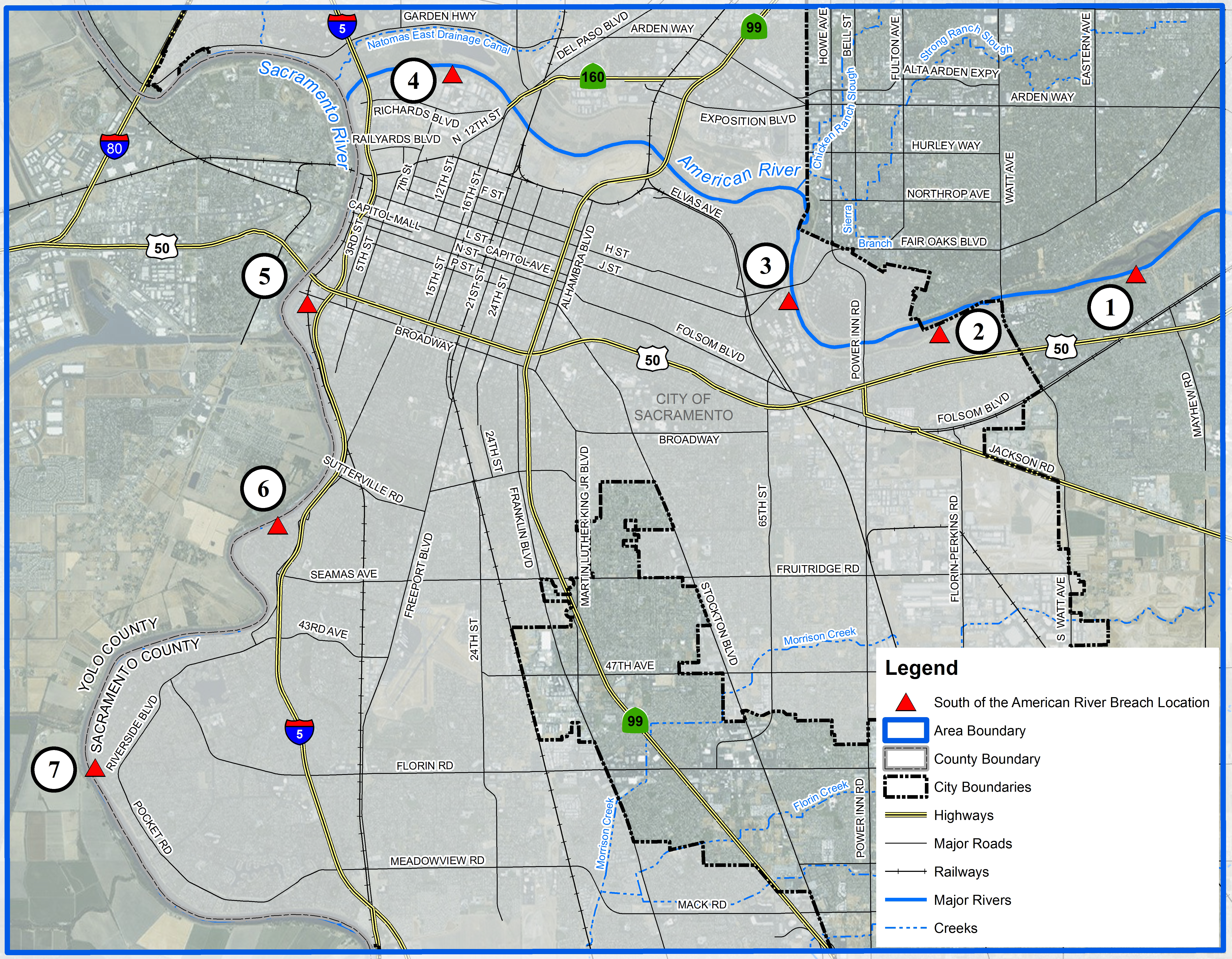
What These Maps Show
Depths During Flooding:
These maps show where the water would flow over time and how deep it would get given the hypothetical flooding scenario.
Evacuation Areas:
These maps indicate places, depending on where the levee breech occurs, that could fill from 1 to 26 feet of water within 10 days, giving most people time to get out safely. Flood depth details are specified on each map.
Escape Routes:
These maps show which evacuation routes would become inundated over time. During intense or prolonged storms, listen to emergency officials and comply with the instructions they give you. If the power goes out, be prepared to hear such emergency instructions with a battery operated radio, and have spare batteries on hand.
Geographic/Neighborhood Specific Maps:
Chose an area/neighborhood to view potential flood concerns, how fast locations may receive water, and which directions to go to escape.
Floods of 2017: A Bird's Eye View
This is a virtual overhead view showing the path flood waters took in the Point Pleasant area during the flooding in February 2017.
Evacuation Terms
Be aware of what emergency officials are telling you in terms of an evacuation notices. Sacramento County and the Operational Area uses the following guidance for evacuation notices and has adopted the following:
- Evacuation Warning: An Evacuation Warning is the official tern1inology used to alert people in an affected area(s) of a potential threat to life and property. People who need additional time should consider evacuating immediately when this notice is given, rather than waiting for an Evacuation Order. An Evacuation Warning prepares the public for the potential of an Evacuation Order.
- Evacuation Order: An Evacuation Order requires the immediate movement of people out of an affected area due to an imminent threat to life. Choosing to stay could result in loss of life. Staying 1nay also impede the work of en1ergency personnel. Due to the changing nature of the en1ergency, an Evacuation Order 1nay be the only warning that people in the affected area(s) receive.
High Ground
Generally, you will not need to drive for hours to be safe if a levee fails. You only need to get to high ground. Plan ahead and make arrangements with family or friends whose homes are on high ground. Good areas to aim for:
Carmichael, Citrus Heights, Cities along the I-80 corridor such as Rocklin and Auburn, Folsom and Davis. In general, going north on I-5 or Highway 99 is not advised because of low spots and the fact that several rivers and tributaries are draining southward in that vicinity. Heading south on Highway 99 is also uncertain because it can flood.
Shelters
Emergency officials will open shelters as required. Shelter locations depend on where a levee break occurs and the associated flooding scenario.
For information on road closures in the unincorporated county, go to SacDOT and click on road closures at the bottom in the left column.