A Watershed Management Plan was developed to describe the regulatory framework, planning and coordination to reduce flooding caused by development on a watershed basis in Sacramento County. Development, consisting of buildings, parking lots, streets, gutters, drainage pipes and channels create impervious surfaces and speed up the flow of runoff that result in increases in storm runoff volumes and peak discharges. The impact of proposed development on existing development and hydraulic conveyance systems should always be evaluated.
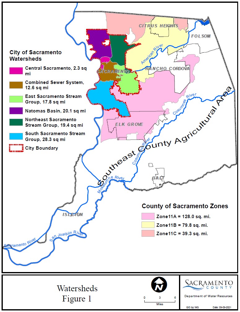
Sacramento County lies mostly in the trough of the Sacramento Valley in the northern portion of the Central Valley of California. The county is bound on the east by the Sierra Nevada foothills and extends to the southwest into the Sacramento Delta. The county totals 994 square miles and has seven incorporated cities. There are seven incorporated cities in the County of Sacramento including:
• Citrus Heights
• Elk Grove
• Folsom
• Galt
• Isleton
• Ranch Cordova
• Sacramento
The total population of Sacramento County (2020) is 1,555,365.
Additionally, there are three adjacent counties, Placer County, El Dorado County and Sutter County, that have creek watersheds draining into Sacramento County and to the Sacramento River Delta.
The purpose of this plan is to provide an understanding of the region’s watershed behaviors to base future decisions on that will reduce the increased flooding from development on a watershed-wide basis.
This plan will:
- Evaluate future conditions
- Identify wetlands and natural areas
- Address the protection of natural channels
- Provided a dedicated funding source for implementing the plan
Sacramento County Flood Insurance Rate Maps were first issued March 15, 1979 and the county has continuously been a community in good standing with the National Flood Insurance Program (NFIP). Each city has a Federal Emergency Management Agency (FEMA) NFIP community number and an independent relationship with the NFIP.