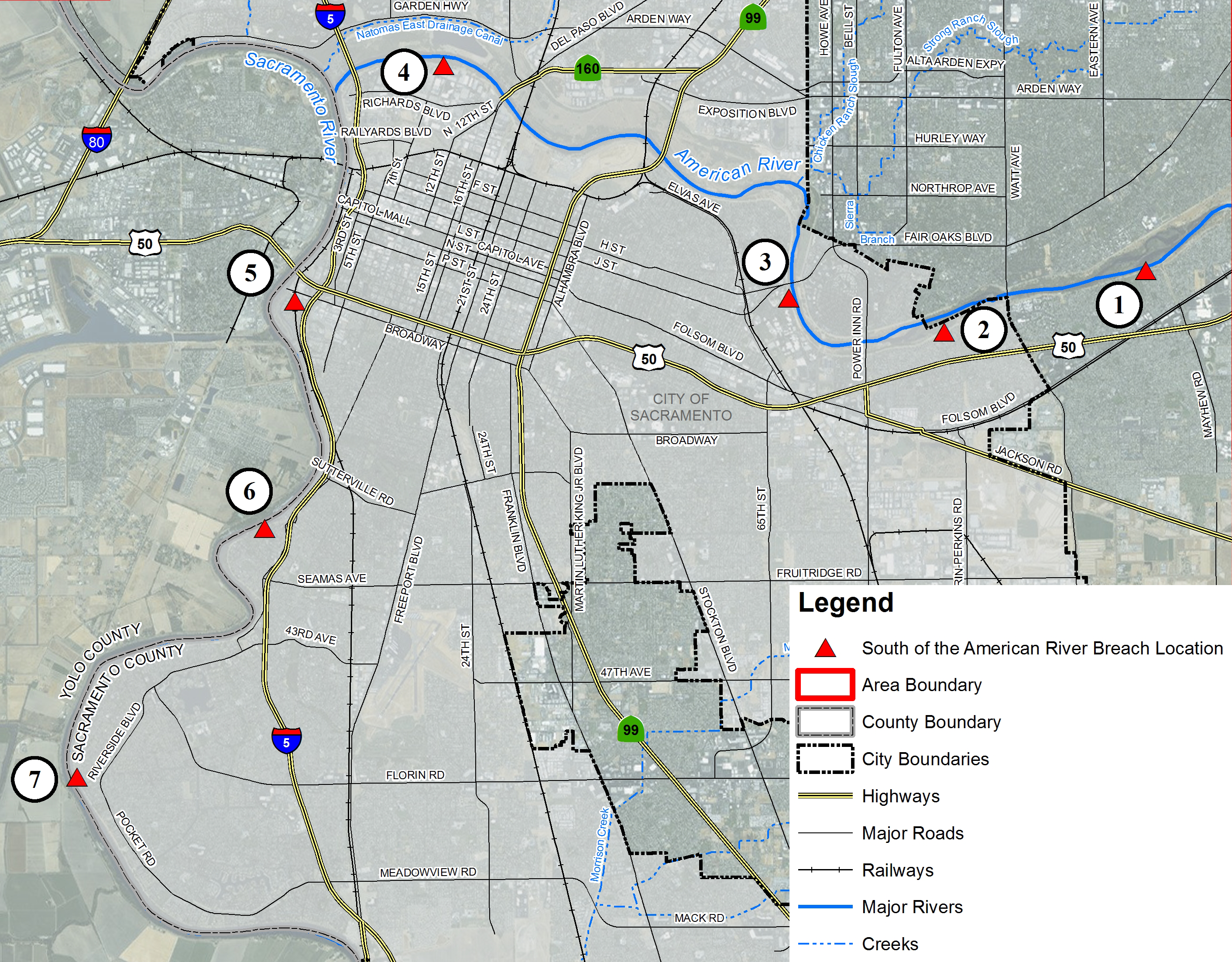
This map details the locations south of the American River where flooding could occur. Community within this boundary include: Curtis Park, East Sacramento, Florin, La Riviera, Land Park, Meadow View, Midtown, North Oak Park, Parkway, Pocket, Rosemont, and Tahoe Park.
The red triangles denote potential levee breach locations. The chart below are links to flood depth and evacuation maps for each area.